
Maps
PHOTO: Size of Hurricane IRMA vs Size of HAITI - We are in Trouble!
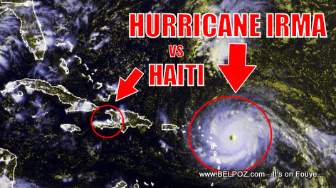
Look at this photo... Look at the size of Hurricane IRMA as it approaches the Caribbean... Compare it to the size of Haiti and you know we are in BIG trouble.
Hurricane IRMA can swallow the entire Republic of Haiti. That's how big of a storm she is.
Map Of The Louisiana Purchase
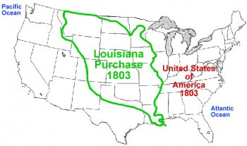
Did you know? The louisiana Purchase is a directly linked to the Haitan Revolution of 1803.
Here is a map of all the states and provinces included in the Louisana purchase. It is more than just Louisiana.
Read this article:
The Louisiana Purchase, Product of The Haitian Revolution
http://www.haitianinternet.com/articles.php/469
 Which model country is Haiti trying to be like?
  Haitian-American Karine Jean-Pierre makes history as first black US...
  List of Countries Haitians can Travel to without a Visa
  Anyone with a gun in Haiti automatically becomes an authority and we...
 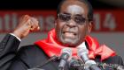 PHOTO: Robert Mugabe - Former President of Zimbabwe
  Jovenel Moise will not be able to visit Pont Rouge on October 17th,...
  Scene of Motorcycles piled up at a gas station in Haiti looking waiting...
  Haitian-Japanese Naomi Osaka - Italian Open 2019
  PHOTO: Wyclef Jean in graduation Uniforms
  The Hispaniolan Solenodon, Called Nen Long in Haitian Creole
  PHOTO: Naomi Osaka and Michael B. Jordan
  2018 WTA Finals - Naomi Osaka vs Sloane Stephens
  PHOTO: Roody Roodboy and his mother
  Naomi Osaka and Coach Sascha Bajin
 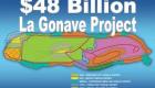 La Gonave Haiti - The 48 Billion Dollar Project
  When foreigners ask me how is Haiti doing, this is what I tell...
  Haitian Journalist Roberde Celine dit Bob C., L'original, le...
  Embracing Identity: Why some Haitian women retain their maiden...